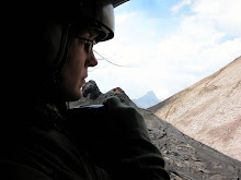
 For a little more than a week, I joined a PSU grad student working on the geology of the Burica Peninsula.
We began in Puerto Armuelles, the most populated town in the region. The goal was to map the peninsula to determine what structural features are present that indicate faulting. Already aware of the Triple-Point Junction just offshore from the point of Burica, we were prepared to encounter fault characteristics throughought the entire region. An interesting feature that I wasn´t familiar with is the series of benches that form when shorelines are repeatedly uplifted. We could drive by such structures and note: Yes, there´s another one!
 Previous work has been conducted in this area - a region shared almost equally with Panama and Costa Rica. As we used the former published work for a reference, we learned what details needed to be added to the first map and also how the structural model will have to be changed now that new evidence exists for different geologic mechanisms.
This work will continue over the next few years - there´s a lot of terrain to cover on foot! Few direct routes exist for crossing the peninsula and a number of traverses will be necessary to trace such large-scale features as synclines, normal faults (or was it transform?), benches, and truncated lahar flows.
I hope I can join the field mapping in the future!


No comments:
Post a Comment