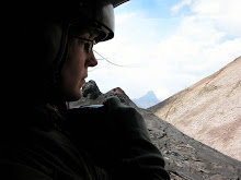
Obituary
"Rocky" Crandell, a giant in Northwest volcanology
Legendary Northwest volcanologist "Rocky" Crandell uncovered Mount Rainier's menacing past and warned of Mount St. Helens' eruption.
By Sandi Doughton
Seattle Times science reporter
When newly minted geologist Dwight "Rocky" Crandell was assigned to map the Puget Sound lowlands southeast of Seattle in the early 1950s, conventional wisdom held that the landscape was shaped mainly by glaciers.
But the sharp-eyed Dr. Crandell began filling his notebooks with observations of what appeared to be deep layers of mud underlying towns from Enumclaw to Auburn. Over several years, the U.S. Geological Survey (USGS) scientist tracked the mud to its unexpected source: High on the flanks of Mount Rainier.
The evidence Dr. Crandell and his partner, Don Mullineaux, pieced together proved the volcano's summit had collapsed 5,600 years ago, unleashing a landslide so massive it flowed all the way to Puget Sound and filled nearby valleys with a slurry up to 400 feet deep.
The realization that such an event could happen again, with hundreds of thousands of people now populating Rainier's fringes, shaped much of Dr. Crandell's subsequent career.
He and Mullineaux pioneered the approach used today to evaluate the hazards posed by volcanoes. Two years before Mount St. Helens' 1980 blast, they warned that the restless volcano was primed to erupt. Before and after the eruption that claimed 57 lives, Dr. Crandell and Mullineaux worked around the clock in shifts to brief public officials, from then-governor Dixy Lee Ray to President Carter.
Dr. Crandell died Monday (April 6) of a heart attack at a hospice in Wheat Ridge, Colo. He was 86.
"He really was a giant in the field of volcanology in the Pacific Northwest," said Dr. Crandell's daughter Jane Crandell Monserud, of Seattle.
Dr. Crandell collected rocks as a child in Illinois, but he didn't get the nickname Rocky until his first college field trip in 1941. He was a lieutenant in an Army mortar platoon in Germany during World War II and earned a doctorate at Yale after the war. His first job was with the USGS office near Denver, where he was based throughout his career.
Before Dr. Crandell's work on Rainier, no one realized the picturesque volcano had such destructive potential, said former USGS volcanologist Dan Miller, who started working with the fledgling volcano team in the early 1970s.
Miller credits the breakthrough to Dr. Crandell's skill for geologic observation and his open-minded way of considering all possible explanations. "It was a brilliant piece of detective work."
While Dr. Crandell and Mullineaux were scouring rural Pierce County for evidence of Rainier mudflows, they began to find puzzling layers of volcanic ash that they eventually traced to Mount St. Helens. They embarked on a detailed study of the younger volcano's violent past, resulting in a 1978 report that warned of a likely eruption within the next 20 years.
Miller spent time with the two veterans at their field camp on the shore of Spirit Lake, where days began with a dip and ended with gin and tonics under the stars. The hours in between were grueling. "Rocky was a consummate field geologist," Miller said. "He was willing to hike miles and miles to get to an outcrop, and go back day after day."
Most early volcanologists only paid attention to hardened lava flows. But volcanoes can also spew ash clouds, rain chunks of rock and let loose mud flows and the searing mixtures of gas and rock called pyroclastic flows. Dr. Crandell and Mullineaux mapped all of those deposits, giving birth to the field now called volcanic hazard analysis, which looks at everything a volcano has done in the past to predict how it's likely to behave in the future.
"That was really Rocky's idea," Mullineaux said. "It's now used around the world, but when we were making the first map, nothing else like it existed."
As a result of volcano-hazard mapping, several valleys downstream of Mount Rainier are now equipped with mudflow-warning systems. Some cities restrict development in vulnerable areas, and others hold regular evacuation drills.
Dr. Crandell and Mullineaux drew some criticism after Mount St. Helen's cataclysmic eruption. A few victims' families claimed the USGS scientists didn't press hard enough for larger exclusion zones.
But the boundaries were set by public officials, and there was scant indication in St. Helens' history that it would explode with such fury, Miller said.
Dr. Crandell retired a few years after the St. Helens eruption, partly to make way for young scientists. But he continued to do unpaid field work for another decade.
After his wife, Marion, suffered a brain injury in an automobile accident, Crandell devoted much of his time to her, said his daughter Margie Robinson, of Wheat Ridge, Colo. Mrs. Crandell died in 2004. Two years ago, Dr. Crandell visited Mount Rainier with his daughters to scatter her ashes. They also made a stop at Mount St Helens' visitor center.
Rangers and staff came from across the park to meet the man whose work remains the bedrock of volcanology in the Northwest.
"You should have seen the commotion," Monserud said. "Dad was greeted like a rock star."
In addition to his two daughters and their husbands, Dr. Crandell is survived by three grandchildren and one great-grandchild. His son, Tom, died in a river-rafting accident in 1965.
A service will be held April 18 at Jefferson Unitarian Church in Golden, Colo.
Source:
http://seattletimes.nwsource.com/html/localnews/2009016972_crandellobit10m.html
Tuesday, April 21, 2009

Tuesday, March 31, 2009
Fieldwork, continued
The driest I've ever seen it:
 In this view, Volcán Barú has a few clouds gathering around the summit but otherwise there's hardly a breath of moisture in the air. The intervening "hummocks" in the fore-and-middle ground are dusty and brittle grass covers the slopes. But this weather won't last long. Despite how brutal the Death Valley-like weather is for hiking and traversing the campo, I'm not looking forward to the polar opposite: knee-high mud and drenched notes.
In anticipation of the winter rains, I've packed in 2 weeks of fieldwork... más o menos. A modified Debris Avalanche map has come from this as well as many new outcrop descriptions and field photos. Should I post the new gritty details? I don't think I have time and it might not be as interesting to read as it would be to type. But regardless, I'd like to share some of the most interesting photos from last week. I haven't spent a lot of time on the Rio Chiriqui Viejo, but each time I visit it, I'm never disappointed; there is always something interesting to see. This time, I saw Squirrel Monkeys (thanks for the correction Holly!). Maybe I've seen these small, masked critters in photos, but never live, in the wild. This view shows 3 of them playing in a tree high above the riverbank. What the photo doesn't show is the object of their game: a white, black-speckled bird of prey that was circling the tree.
Aaaah, the benefits of a good zoom, here's a portrait of a member of the trio.
 Southeast of the Rio Chiriqui Viejo are several other rivers. An important one figuring into my mapping project is the Rio Divalá. While there might be a few small families of Squirrel Monkeys close to the Pacific coast, there are MANY clans of Howler Monkeys. I've spent more than a year in Panamá and I've hardly seen so much wildlife so often - the following photo was taken AFTER the howling began.
 Have you ever heard anything like this?
The following photo isn't mine, but I wish it was. There have been so many times when I've seen a Blue Morpho butterfly - whether out of the corner of my eye or disappearing into the shadows - that it is starting to drive me crazy. These are beautiful marvels, something you can't observe wild in the USA and yet, every time I see the flash of blue, there is never enough time to pull out the camera and focus in on the insect. These butterflies are just that fast. Like the day I spent walking the upper reaches of Rio Piedra: I saw the Blue Morpho in the shadows, immediately dropped my backpack to the ground, pulled open the drawstrings, unzipped the camera case, pressed "Power," and... the butterfly was gone. I even ran into the trees looking for it and, nope, sorry, "ya se fue," I couldn't find it with my naked eye, never mind the camera lens. But to represent it's presence, I'm using this photo from: http://www.yesnet.yk.ca/schools/wes/webquests_themes/butterfly_lucille/butterfly_species/morpho/index.html
Oh, I'll keep trying - I'll keep looking out for those beautiful wings. Besides, it's flashing my favorite color and few things can wear blue so nicely.
 In this view, Volcán Barú has a few clouds gathering around the summit but otherwise there's hardly a breath of moisture in the air. The intervening "hummocks" in the fore-and-middle ground are dusty and brittle grass covers the slopes. But this weather won't last long. Despite how brutal the Death Valley-like weather is for hiking and traversing the campo, I'm not looking forward to the polar opposite: knee-high mud and drenched notes.
In anticipation of the winter rains, I've packed in 2 weeks of fieldwork... más o menos. A modified Debris Avalanche map has come from this as well as many new outcrop descriptions and field photos. Should I post the new gritty details? I don't think I have time and it might not be as interesting to read as it would be to type. But regardless, I'd like to share some of the most interesting photos from last week.
 I haven't spent a lot of time on the Rio Chiriqui Viejo, but each time I visit it, I'm never disappointed; there is always something interesting to see. This time, I saw Squirrel Monkeys (thanks for the correction Holly!). Maybe I've seen these small, masked critters in photos, but never live, in the wild. This view shows 3 of them playing in a tree high above the riverbank. What the photo doesn't show is the object of their game: a white, black-speckled bird of prey that was circling the tree.
Aaaah, the benefits of a good zoom, here's a portrait of a member of the trio.
 Southeast of the Rio Chiriqui Viejo are several other rivers. An important one figuring into my mapping project is the Rio Divalá. While there might be a few small families of Squirrel Monkeys close to the Pacific coast, there are MANY clans of Howler Monkeys. I've spent more than a year in Panamá and I've hardly seen so much wildlife so often - the following photo was taken AFTER the howling began.
 Have you ever heard anything like this?
The following photo isn't mine, but I wish it was. There have been so many times when I've seen a
 Blue Morpho butterfly - whether out of the corner of my eye or disappearing into the shadows - that it is starting to drive me crazy. These are beautiful marvels, something you can't observe wild in the USA and yet, every time I see the flash of blue, there is never enough time to pull out the camera and focus in on the insect. These butterflies are just that fast. Like the day I spent walking the upper reaches of Rio Piedra: I saw the Blue Morpho in the shadows, immediately dropped my backpack to the ground, pulled open the drawstrings, unzipped the camera case, pressed "Power," and... the butterfly was gone. I even ran into the trees looking for it and, nope, sorry, "ya se fue," I couldn't find it with my naked eye, never mind the camera lens. But to represent it's presence, I'm using this photo from: http://www.yesnet.yk.ca/schools/wes/webquests_themes/butterfly_lucille/butterfly_species/morpho/index.html
Oh, I'll keep trying - I'll keep looking out for those beautiful wings. Besides, it's flashing my favorite color and few things can wear blue so nicely.
Wednesday, March 18, 2009
Project: Volcan Baru
 There are often surprises in the field, but this one had nothing to do with rocks. Within the river valley of Rio Escarrea, this blue-crested motmot was hiding from the afternoon sun - well, the sun as well as intruders... like me!
Subscribe to:
Posts (Atom)