The adventure shed light on the far corners of the field while also establishing a scope for the project. While new questions cropped up during the trip, the theme never changed:
What is going on with these debris deposits?!
What we were looking for:

Multi-colored, buried blocks that explain the insides of debris avalanches. Within massive quarries, road and stream-cuts, and construction sites, the presence OR absence of these features provides information about composition and energy.
Textures, when volcanoes fall down, particular things happen to the rocks: fracturing, shattering, shearing, disaggregation... that is to say: busted up. Something we're seeing at the distal end of the
 deposit is jigsaw fracturing. Not every block is like this, but by now I've seen enough of these to link it with the mixed-up phase of the avalanche. This photo is an example, rock hammer for scale.
Topographic clues, despite the estimated age of the events, the topography still tells us something about the past - and adds a few more questions to the whole picture, but it's no good to ignore the hints given by aerial photos, digital elevation models, topo maps, and panoramic views.
 There is a 20-square kilometer area that is dissected by erosion and abruptly becomes high, rolling plateau - why?
 Carbon samples, wood or charcoal or bulk soil samples that can date or at least constrain the timing of events. As far as I'm concerned, finding 7 samples within a 5-day visit is as good as it gets for a debris avalanche.
Contacts, we were lucky to gain access to the largest construction site I've seen in Panama. A new dam is going in on the Rio Chiriqui Viejo - I learned that there could be 10 more built sometime in the future, interesting... Here, the excavation is cutting so deeply that we saw both debris avalanche material and the underlying bedrock exposed within the same view.
 Construction workers looked like specks and whether they knew it or not, they were pointing out the unit base for us - thanks guys!
Places like this will be worthwhile to revisit. This kind of construction requires incredible excavation, in the river valley as well as further away where quarries appear to provide gravel for all of the concrete needed to stabilize the slopes.
The 5 days were a success - we have new information and ideas about Volcan Baru's debris avalanche deposits. Also, there was time to talk-story with friends and enjoy the best sunset spot I've ever seen in Panama.


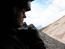
 What is this rocky prairie? This photo was taken just seconds before the clouds moved in completely to take away the view of the summit dome. My volcanological companions and I visited Volcan Baru´s amphitheater during an uncharacteristically rainy week. After exploring the area of La Yeguada with PCVs Karinne and Noah, we took the Interamericana, headed west, then drove due north to the volcano. This was a good time to visit the largest known debris avalanche in Central America. The photo above is a view into the amphitheater of Volcan Baru. We are standing on a lahar surface and looking roughly East up into the dome complex. Too bad about the weather, the summit antennas are already hidden by the incoming rain.