The research I plan on doing based on Volcan Baru is progressing, just as it has been since I arrived, but NOW it's time to actually blog about it.
After a year spent in-country and focusing on Peace Corps activities, the hardcore geology work is now ready to take center stage. That is to say, when I'm not juggling aqueduct and latrine construction, I am hiking (or bicycling as it may be) out to my field area to map a volcanic deposit.
The fieldwork has already begun and I'm not joking about taking a bike, my research area is huge and there is a lot of ground to cover. Where am I working? Here:

(The USGS map shows 3 shaded areas: blue is Volcan Baru's edifice, brown is the lahar flow field, and in green is where I am working: the debris avalanche deposit, DAD. The original paper where you can see this map and the full explanation is here: http://pubs.usgs.gov/of/2007/1401/)
How do you map a VDAD? The primary features I'm focusing on are the hummocks, already deeply buried by thousands of years of lahar flows, but with a little help of aerial photos and lots of time spent "hoofing it" - I'll be able to map out the extent of the region and hopefully gather enough information to explain how such a large-scale event occurred and when.
More fieldwork should have happened in November, but renewed construction in-site and VERY bad weather changed my plans. During the week of the 16th a major storm system approached Panama's northern coast. A huge cell of rain (is that correct to say? maybe it's better to say "cells") moved in from the Caribbean and sat over the shoreline dumping rain and rising winds. Rivers were flooding, small streams graduated to rushing highways of mud, landslides covered major roads, bridges were damaged, houses were washed away, fincas were drowned, and unfortunately, some rescue efforts failed.
 (Photo by Angel Rodriguez; road to Cerro Punta; Rio Chiriqui Viejo)
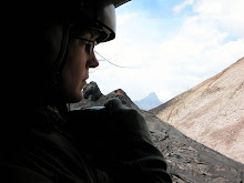
 (Photo by SINAPROC staff; aerial view of flooding in Bocas del Toro, Nov. 16-30, 2008; http://www.sinaproc.gob.pa)
Formal report here: United Nations report
PC Volunteers were evacuated where possible, in some cases it was better to ride out the storm than cross the bay of Bocas del Toro, but it's going to be difficult for many of them to return to their sites.
Good luck you guys!


No comments:
Post a Comment